Leave Atlanta on GA 400 on a Friday afternoon in late October and the state changes under you three times before dinner. Strip malls give way to pasture around Cumming, pasture gives way to chicken houses and kudzu past Dawsonville, and somewhere north of Dahlonega the road starts bending for reasons the map does not explain. That is the argument for Georgia road trips in one sentence: this is a big, geologically confused state where an hour of driving buys a genuinely different landscape, and the good parts are almost never on the interstate. This guide maps nine routes worth the gas, with real mileage, honest drive times, what each stop costs (checked September 2026), and — the part most round-ups skip — which celebrated drives do not repay the detour. Georgia here is the American state: Atlanta, the Blue Ridge, roughly a hundred miles of Atlantic coast. Not the country in the Caucasus, which has its own excellent mountain roads and is not what you came here for.
One fact frames everything below. Georgia is the largest state east of the Mississippi by land area, stacked north to south in four provinces: Ridge and Valley country in the northwest, the Blue Ridge across the top, rolling red-clay Piedmont through the middle, and flat Coastal Plain below the Fall Line. You cross all four driving from Chattanooga to Cumberland Island, and each drives differently — different road geometry, different hazards, different reasons to pull over. Plan by province rather than by mileage and the trips assemble themselves.
The short answer: which drive, and how long
If you have a weekend and want the highest scenery-per-mile in the state, drive the Russell–Brasstown Scenic Byway loop out of Helen. If you have a week, run Georgia top to bottom: mountains, Antebellum Trail, coast. If you have one day out of Atlanta, the Cohutta foothills northwest and the Antebellum Trail southeast are the only two that do not leave you driving home in the dark wondering why you bothered.
| Route | Core mileage | Wheels-moving time | Best season | Base towns |
|---|---|---|---|---|
| Russell–Brasstown Byway loop | 40.6 mi byway, about 110 mi as a loop | 3–4 hrs driving, a full day with stops | Late Oct; Nov–Mar for long views | Helen, Blairsville, Hiawassee |
| Cohutta–Chattahoochee Byway | 54 mi | 2 hrs driving, half a day | Apr–May, Oct | Dalton, Chatsworth, Ellijay |
| US 441 north, Athens to the state line | About 115 mi one way | 2.5 hrs, two days with stops | Late Oct; spring for waterfalls | Clayton, Clarkesville, Helen |
| Antebellum Trail, Athens to Macon | About 100 mi | 2.5 hrs, two days done properly | Late Mar; Oct–Nov | Madison, Milledgeville, Macon |
| Atlanta to Savannah the slow way | About 330 mi against 250 on the interstate | 7 hrs against 3.5 | Mar–May, Sep–Nov | Macon, Dublin, Statesboro |
| Coastal, Savannah to St. Marys | About 130 mi plus island spurs | 2.5 hrs, three or four days with islands | Mar–May, Sep–Nov | Savannah, Darien, Brunswick, St. Marys |
| Pine Mountain and FDR country | About 70 mi as a loop from Columbus | 2 hrs, a full day | Late Mar–Apr for azaleas | Pine Mountain, Warm Springs, Columbus |
| Southwest: Columbus, Lumpkin, Plains | About 150 mi | 3.5 hrs, two days | Oct–Apr; brutal in July | Columbus, Americus |
| The Okefenokee run | About 120 mi from I-95 | 2.5 hrs, two days minimum | Mar–Apr, Oct–Nov | Folkston, Fargo, Waycross |
How these routes were chosen
Every state tourism office publishes a byway list, and most such lists are political artifacts: a corridor gets designated because a county commission applied, not because the driving is good. Georgia’s Department of Transportation had designated seven state scenic byways by 2004 — Ridge and Valley, Russell–Brasstown, South Fulton, Monticello Crossroads, Altamaha, Piedmont and Cohutta–Chattahoochee — and the list has grown since, with wildly variable quality. So the routes below were filtered four ways.
- The road itself has to be worth driving, not merely a line connecting attractions you could reach faster on an interstate. GA 348 qualifies; a flat US highway between two towns with a museum at each end does not, however many brown signs it carries.
- Stops have to survive sequencing. A route works only if the stops fall in an order that does not force backtracking, and if at least one is open on the day you are likely to drive it. Georgia’s state historic sites close Mondays and Tuesdays more often than visitors expect.
- Somewhere to sleep at the end. Routes that dead-end 90 minutes from a bed get demoted, and where the overnight options are thin — in south Georgia they often are — the route text says so.
- Verifiable practicalities. Fees, hours and access rules appear only where an operator or agency publishes them somewhere checkable. Where a figure is not published — and Georgia has more of those than you would expect — the text says so instead of inventing a number.
What driving in Georgia actually feels like
Four realities shape every itinerary here, and trip planners leave all four out.
I-285 is not merely a rush-hour problem
The Perimeter, the loop that rings Atlanta, congests at times that have nothing to do with commuting. Midday Tuesday, two o’clock on a Sunday, nine at night on a Thursday — the northern arc between I-75 and I-85 backs up on a schedule of its own. Budget an extra 45 minutes for any trip crossing metro Atlanta, and cross before 6:30 a.m. or after 8 p.m. if the route allows. The I-85 and I-75 express lanes are genuinely faster but need a Peach Pass transponder and price dynamically, so the number on the gantry is the number for that minute. A rental car driven into an express lane without a transponder becomes a bill in the mail six weeks later.
I-16 is 165 miles of nothing, and there is no fix
The interstate between Macon and Savannah is the emptiest major road in Georgia: pine plantation, a scattering of exits with services, and long stretches where the only landmark is a radio tower. It is also the fastest way to the coast, and no scenic alternative costs less than two extra hours. Accept it, fuel in Macon or at the Dublin exits, and load a podcast queue. Drivers who try to make I-16 interesting arrive disappointed; drivers who treat it as a transfer arrive fresh.
Mountain roads close, and the closures are badly advertised
GA 348, GA 180 and the higher reaches of GA 60 ice over in winter and are gated with little warning. Fog in the gaps is the more common hazard, and a more dangerous one than the curves, because it arrives on clear mornings in spring and fall when nobody is expecting it. Check Georgia 511 at 511ga.org before committing to a mountain route between December and March, and if you are driving a byway at dawn in October, expect 20 mph in the gaps until the sun burns it off.
Fuel and charging thin out fast off the interstates
The I-75, I-85 and I-20 corridors are well served. Everywhere else, plan. The Russell–Brasstown byway has no fuel, no food and patchy cell coverage along its entire length; the last dependable stops are Helen at one end and Blairsville at the other. The Okefenokee approaches are similar — Folkston and Fargo have what they have, and what they have closes early. An electric vehicle is fine on the interstates and workable in the mountains with planning, but sustained climbing eats range. Once you leave a four-lane road, treat half a tank as empty.
Route 1: the Russell–Brasstown Scenic Byway loop
This is the best drive in Georgia and it is not close. The Russell–Brasstown Scenic Byway runs 40.6 miles through the Chattahoochee National Forest, encircling the headwaters of the Chattahoochee River, and it received National Scenic Byway designation on 15 June 2000 — the only road in the state to hold that status. It follows GA 348, GA 180 and GA 17/75 in a rough horseshoe, and the whole thing can be driven in under two hours if you never stop, which would be a waste of a good road.
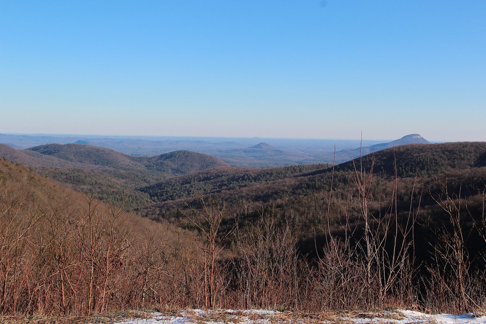
Start in Helen and head north on GA 75, then turn onto GA 348 where a Forest Service sign announces the byway. GA 348 — the Richard B. Russell Scenic Highway — is the reason to come. It climbs out of the Chattahoochee valley in a sustained series of 20 mph switchbacks, tops out at Hogpen Gap where the Appalachian Trail crosses the road, and drops down the far side toward Suches. There is no guardrail on some of it and no services on any of it. Motorcyclists and cyclists use it heavily on fair-weather weekends, log trucks use it year round, and that combination is worth respecting.
From the western end, GA 180 runs east past Lake Winfield Scott toward US 129 near Vogel State Park, a reliable place to stretch. The GA 180 Spur climbs to Brasstown Bald, the highest point in the state. Brasstown Bald is Forest Service land, not a state park, so the Georgia ParkPass does not apply: admission is $8 per person during opening hours of 10:00 to 17:00 daily, $5 outside them. A shuttle runs to the summit deck, with no service between 12:30 and 13:10 and the last one up at 16:30; miss it and the walk is short but steep. From the top you get the only genuine 360-degree view in Georgia, which on a clear winter day reaches four states and on a hazy August afternoon reaches about eight miles.
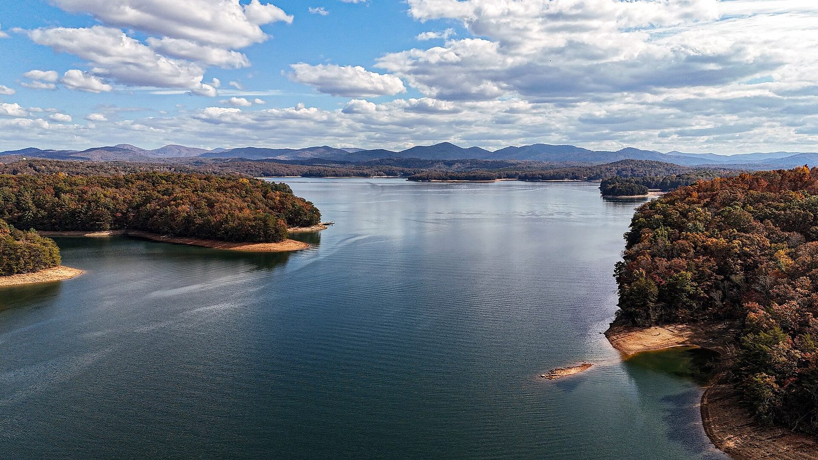
Close the loop on GA 75 south through Unicoi Gap back to Helen. Two detours earn their time. Anna Ruby Falls, two miles from Unicoi State Park on Forest Service land, costs $3 per person aged 16 and over and opens daily 09:00 to 18:00, weather permitting; the paved path to the base is short. The Dukes Creek and Raven Cliff trailheads on GA 348 are the other, and both car parks fill by ten on an October Saturday.
The honest verdict on the byway
Drive it between November and March. The overlooks on GA 348 were cut for a view, and from May to October that view is a wall of leaves ten feet from your bumper. In bare-tree season the same pull-offs show you ridge after ridge to the horizon, and you will have the road to yourself. The trade-off is the ice risk, so check conditions the morning you go. Anyone whose calendar forces a summer visit should treat the byway as a driving road rather than a viewing one and budget more time for the waterfalls, which are at their best when everything else is green.
Route 2: the Cohutta–Chattahoochee Byway and northwest Georgia
Northwest Georgia gets skipped, which is its charm. The Cohutta–Chattahoochee Scenic Byway runs 54 miles from historic Prater’s Mill in Whitfield County, follows State Route 2 into Murray County, picks up US 41 and a string of quiet county roads, skirts Chatsworth, then climbs State Route 52 to a mountaintop overlook on the shoulder of Fort Mountain. The climb up 52 is the payoff — a genuine mountain road with a view back across the Great Valley, and far less traffic than anything in the Helen orbit.
The same corner of the state holds the Chieftains Trail, which strings together the most substantial Native American sites in Georgia. Etowah Indian Mounds at Cartersville preserves a Mississippian town with a temple mound you can climb, open seven days 09:00 to 17:00 with the mounds closing at 16:30. Because it is a state historic site rather than a state park it charges per-person admission and the ParkPass does not cover it — no 2026 figure is published anywhere checkable, so budget for a modest gate fee rather than a number this guide can quote.
North of Etowah, New Echota at Calhoun was the Cherokee Nation’s capital from 1825 until the removal of 1838, preserving the Supreme Courthouse, the Council House and the print shop that produced the bilingual Cherokee Phoenix. It is also a historic site, so admission is per person. Visiting New Echota and Etowah on the same day, in that order, gives you something no single museum in the state manages: the arc from a Mississippian town through a constitutional Cherokee republic to a forced removal, inside 40 miles of driving.
Dalton, Calhoun and Cartersville all sit on I-75, so this loop is easy to reach and easy to abandon halfway. Cloudland Canyon, west on Lookout Mountain via GA 136, adds an hour each way and is better treated as its own trip.
Route 3: US 441 north, Athens to the Carolina line
US 441 from Athens to the North Carolina state line is the most useful north–south road in Georgia that most visitors have never driven. It is four lanes for much of its length, which makes it fast, and it threads a sequence of stops that would each justify a detour on their own.
Leaving Athens, the road runs through Commerce and up into the Habersham County towns — Baldwin, Cornelia, Demorest, Clarkesville — where the Piedmont visibly stops being flat. Toccoa sits a short detour east, and Toccoa Falls on the college campus there drops 186 feet in a single ribbon, taller than Niagara’s 167 feet.
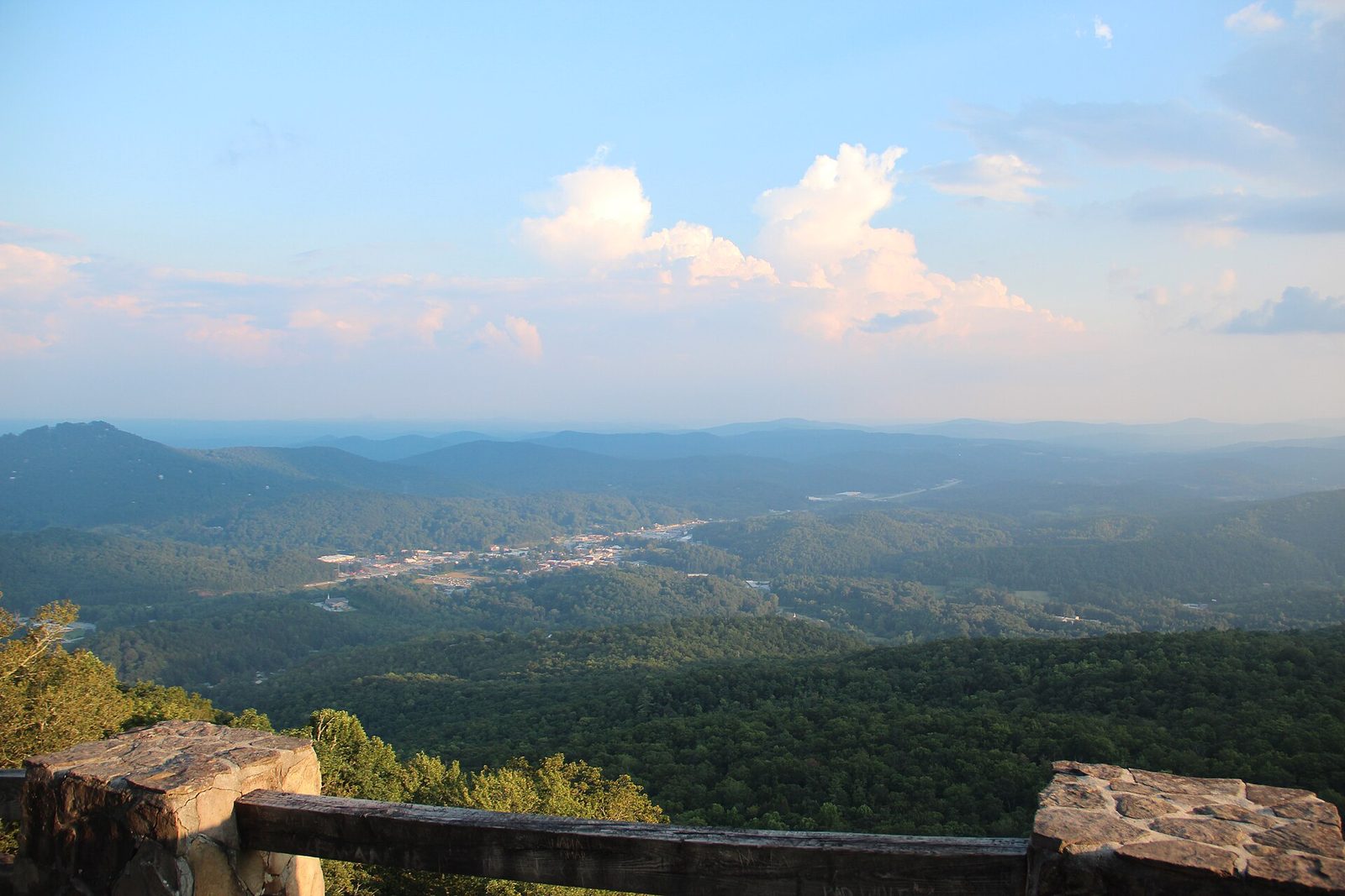
North of Clarkesville the road reaches Tallulah Falls and the gorge, and this is where the route needs planning rather than spontaneity. Tallulah Gorge State Park allows gorge-floor access only with a free permit, 100 issued per day from 08:00 at the Interpretive Center, and on summer weekends they are gone by about nine. Last permits go out at 16:00 April to October and 15:00 November to March, closed-toe shoes are mandatory, and no permits at all are issued during scheduled water releases. The rim trails and the suspension bridge, about 80 feet above the riverbed, need no permit and are impressive on their own.
Past the gorge, Clayton is the natural overnight and the best food on the route. Black Rock Mountain State Park above Mountain City is the highest-elevation state park in Georgia and its overlooks face west across three states. Dillard and the state line follow. The whole run from Athens is roughly 115 miles and two and a half hours without stops — a comfortable two-day trip and a rushed one-day one.
Route 4: the Antebellum Trail, Athens to Macon
Roughly 100 miles link Athens, Watkinsville, Madison, Eatonton, Milledgeville and Macon along US 441 and GA 15, through the heart of the Piedmont. This is the route for architecture, literary history and small downtowns rather than elevation, and it is the best answer to “what do we do with two days that isn’t the mountains or the beach.”
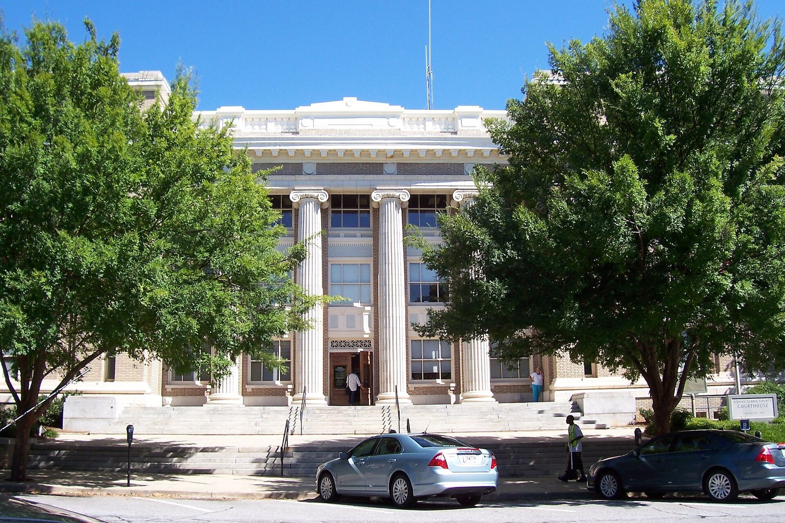
Madison is the stop that needs correcting. The town’s entire marketing rests on being “too pretty to burn,” and it is not true. Sherman’s Left Wing under Major General Henry Slocum did pass through, and it did burn the cotton gin, the depot and the war-supporting industry. What it did not burn were the houses, and the reason was political rather than aesthetic: Joshua Hill, a Madison resident and pro-Union congressman with a connection to Sherman’s brother in Congress, had secured an arrangement beforehand. The houses survived on politics. They are lovely regardless, but the story you will hear on the walking tour is marketing.
Eatonton claims both Joel Chandler Harris and Alice Walker, a strange pairing for one small county seat that says something true about Georgia. Milledgeville was the state capital from 1804 until 1868; the Old Governor’s Mansion and Andalusia — Flannery O’Connor’s farm, where she kept the peacocks — reward a slow hour each. Macon closes the route with Ocmulgee Mounds and its reconstructed Earth Lodge.
One scheduling note worth building a trip around: Macon has roughly 350,000 Yoshino cherry trees and they bloom in late March. The International Cherry Blossom Festival runs ten days in March — 2026 ran 20 to 29 March — and 2027 dates had not been announced as of September 2026, so check cherryblossom.com rather than booking on a guess. In bloom week the town is transformed and hotel rates reflect it.
A note on Ocmulgee’s status, because you will see it described wrongly. House Resolution 9416, the Ocmulgee Mounds National Park Redesignation Act, was introduced on 24 June 2026 and referred to the Subcommittee on Federal Lands on 1 July 2026. It would create Georgia’s first national park plus an adjoining preserve. As of September 2026 it is in committee, not law. It is still a National Historical Park.
Route 5: Atlanta to Savannah the slow way
The interstate run is about 250 miles and three and a half hours: I-75 to Macon, I-16 to Savannah. The slow version is about 330 miles and a full seven hours of driving, and the question is whether the extra three and a half hours buy anything.
The honest answer is: once, yes. The route drops south from Macon on US 80 through Dublin, Swainsboro and Statesboro, crossing the Fall Line and running out across the Coastal Plain through country almost no visitor sees — cotton and peanut fields, courthouse squares, the occasional startling Greek Revival house on a back road. The food in the small towns beats the interstate exits by a wide margin. But it is a one-time drive: no single stop justifies the detour alone, and doing it on a schedule or with tired passengers is a mistake. Take it outbound when everyone is fresh and take I-16 home.
The Fall Line itself is worth understanding because it explains the state. It runs roughly Columbus–Macon–Augusta, marking where the hard rock of the Piedmont meets the sandy Coastal Plain. Above it, red clay, shoals and mill towns; below it, flat pine country, blackwater rivers — and gnats. The gnat line is not a joke. From roughly May through September, anywhere south of the Fall Line comes with clouds of tiny flies that go for your eyes. Locals wave a hand in front of their face continuously and call it the south Georgia salute. Pack a hat with a brim.
Route 6: the coast, Savannah to St. Marys
About 130 miles of coastal Georgia sit between Savannah and the Florida line, and the interesting part is that none of the good stuff is on the main road. I-95 and US 17 run behind the marsh; the barrier islands hang off them on causeways and ferries, and each island has its own access rule.
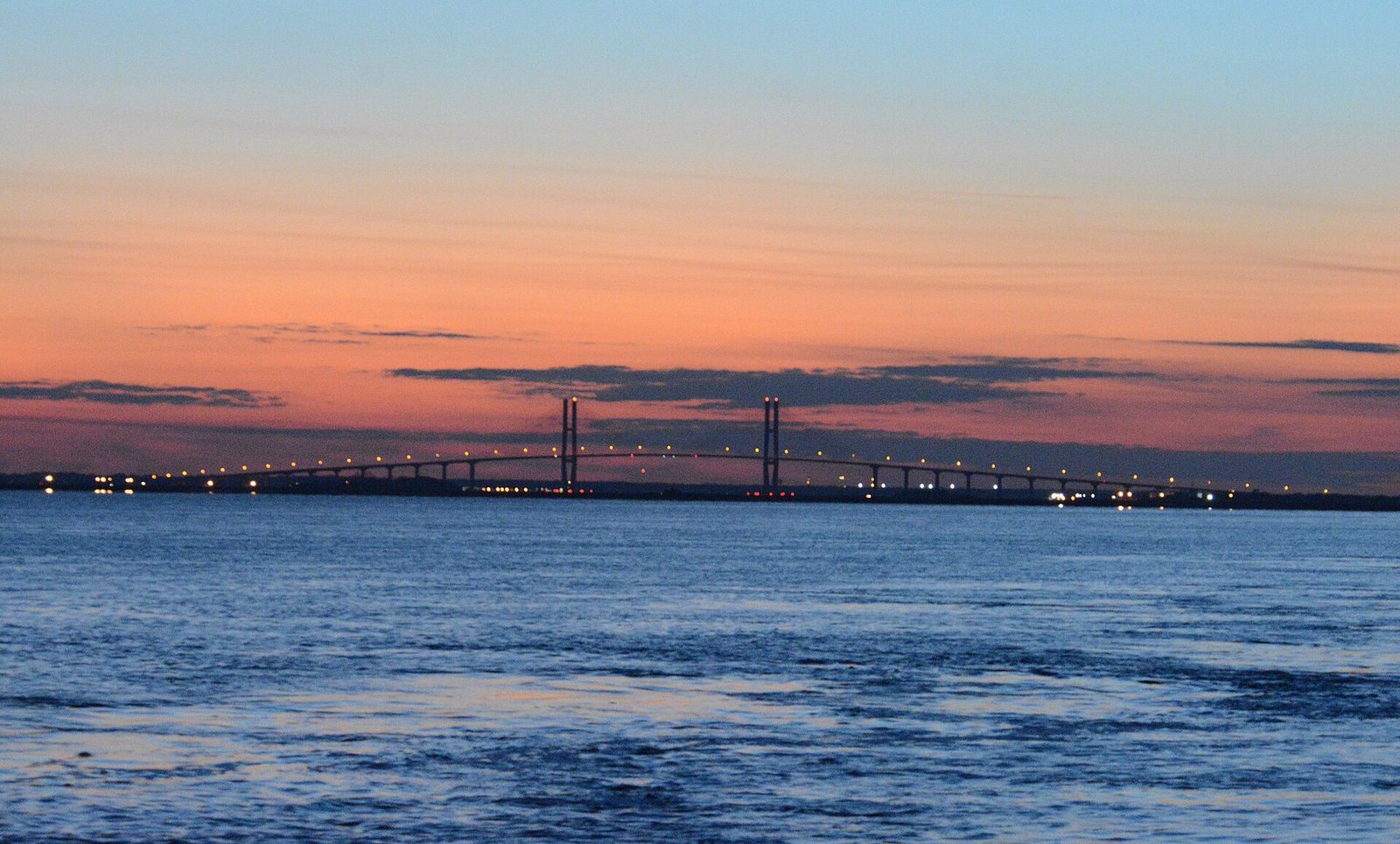
Running south from Savannah: Tybee Island is 18 miles east on US 80, a two-lane causeway across open marsh that floods on king tides and backs up solid on summer Saturdays. Tybee parking is $4 an hour, enforced 08:00 to 20:00 daily — $48 if you stay the day — while a daily pass is $25 and seven consecutive days cost $175. Buy in advance online rather than standing at a kiosk.
Darien and the Altamaha River come next, then Brunswick and the Golden Isles. St. Simons is reached free on the F.J. Torras Causeway; Jekyll Island charges $10 per vehicle per day or $100 annually, with an extra $5 on designated event days such as Independence Day, Shrimp & Grits and Holly Jolly Jekyll — a surcharge on the daily rate only, not the annual pass. Arriving on foot or by bicycle is free. Driftwood Beach on Jekyll’s north end is the most photographed stretch of the Georgia coast, and it is worth the timing effort: go at low tide.
Two islands need planning rather than a causeway. Sapelo is reachable only by passenger ferry from McIntosh County, and the gate most guides omit is that you must be on an organized tour or the guest of a resident — you cannot simply buy a ticket and wander. State-run tours run Wednesday and Saturday mornings, Saturday by reservation.
Cumberland Island is the other, and it is the one to build a trip around. Entrance is $15 per person for seven days for everyone over 16. The ferry from St. Marys is $44 plus tax for adults, $42 for seniors 62 and over and $34 for youth aged 6 to 15, and the crossing takes 45 minutes. Reservations open six months ahead and sell out. The park is cashless, and there is no food, no water and no shop on the island — carry everything in, including more water than you think you need.
One warning for anyone planning to swim. St. Simons has lifeguards only from Memorial Day to Labor Day, 11:00 to 16:00, and only at the Coast Guard Station and Massengale beaches — nowhere else on the island, and not on Jekyll at all. Dog rules and water-quality advisories vary by island and by season; the full breakdown is in the coast guide linked below.
Route 7: Pine Mountain and Roosevelt country
An hour south of Atlanta the Piedmont throws up one last ridge before the Coastal Plain, and GA 190 runs along the top of it through F.D. Roosevelt State Park. You can loop it from Columbus in about 70 miles, and it is the best scenic road in Georgia outside the mountains.
Dowdell’s Knob is the stop. Roosevelt drove himself here in a hand-controlled car to picnic and think, and there is a bronze of him sitting on the wall looking out over the valley. It is an unexpectedly moving place and costs nothing beyond state park entry. The Little White House at Warm Springs, where he died in April 1945, is the other half of the story — go to both or neither, because either alone is incomplete.
Callaway Resort & Gardens covers 2,500 acres at Pine Mountain and anchors the area commercially. General admission ran $24.99 for adults and $15.99 for children in the 1 October to 1 November 2026 window; rates move by season, so check the date you actually want. The azalea bowl in spring is the reason to pay. A November visit is a pleasant walk at a spring price.
Note that Georgia State Parks charge $10 per vehicle per day for parking, up from $5 on 1 January 2026, with an annual ParkPass at $70. If your trip includes three or more state parks — and most of the routes here do — the annual pass pays for itself before you leave. It carries 50% off for ages 62 and over and 25% off for military and veterans, in person only.
Route 8: southwest Georgia, Columbus to Plains
This is the emptiest quadrant of the state and the one where the driving is least interesting, which makes it the route that depends entirely on its stops. Fortunately the stops are extraordinary.
Columbus anchors the west end, and the RushSouth Whitewater Park is the genuine surprise: 2.5 miles of dam-released Class II–V water through downtown, billed as the longest urban whitewater course in the world. Whitewater Express is the only guided operator. No verified 2026 price was available at the time of writing, so book direct.
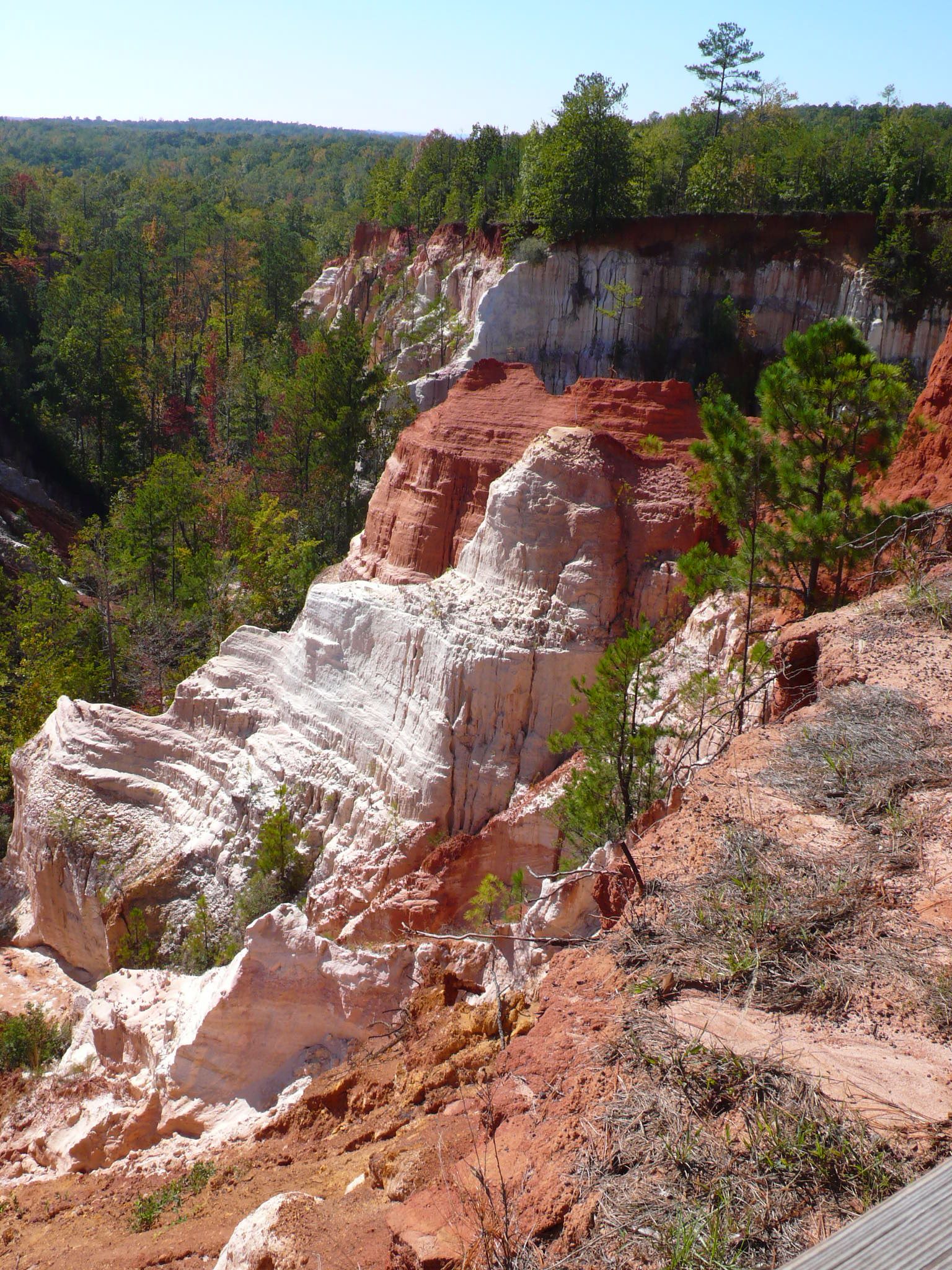
Providence Canyon near Lumpkin is the reason most people make this drive. The state calls it Georgia’s Little Grand Canyon, which oversells the scale and undersells the strangeness: white kaolin and orange clay walls in vertical ribbons, pines growing out of the rim, a floor you can walk. The rarely told part is that it is not a natural wonder at all. The gullies were cut by poor farming in the 1800s, water running off cleared fields into soft sediment, and they are still eroding. It is a monument to soil mismanagement that happens to be beautiful.
From Lumpkin the route runs northeast through Americus to Plains, where Jimmy Carter National Historical Park preserves the boyhood farm, the high school and the train depot that served as campaign headquarters. Andersonville National Historic Site sits a short drive north, holding the ground of Camp Sumter prison camp and the National Prisoner of War Museum. It is a heavy stop and should be — do not schedule it on the same afternoon as anything cheerful. Check current hours on the Park Service site, since these smaller units keep shorter schedules than the headline parks.
Accommodation is the weak point: Americus and Columbus are the only reliable bases. A summer trip through here is also a serious heat proposition — flat, shadeless, with a heat index that makes midday walking genuinely unpleasant. October through April is the window.
Route 9: the Okefenokee run
The Okefenokee National Wildlife Refuge was inscribed as a UNESCO World Heritage Site on 25 July 2026, the 27th in the United States, and that changes the calculus for a trip that was always worth making. The refuge covers 353,981 acres, almost all designated Wilderness, and is also a Ramsar wetland.
Entry is $5 per vehicle for seven days, or $15 annually, at the Folkston and Suwannee Canal entrance, and the same pass is valid at Stephen C. Foster State Park. America the Beautiful passes waive it. Hours run from half an hour before sunrise to 19:30 from March to October and 17:30 from November to February.
Two things trip people up. The refuge runs no tours of its own — boat trips come from Okefenokee Adventures at the Folkston entrance on 912-496-7156 and from Stephen C. Foster on 912-637-5274, and in high season they book out. And wilderness canoe camping permits are released only two weeks ahead, by phone, on selected weekday mornings, which makes a multi-day paddle a planning exercise. Low water has been limiting boat and trail access, so call before committing to a long drive.
The refuge has two faces. The east entrance at Folkston is about 40 minutes from I-95 at Kingsland and is the easy day trip. The west entrance at Stephen C. Foster, reached through Fargo, is nearly two hours further around and is where you go to stay — a designated dark-sky park with the best night sky in Georgia. The two are not interchangeable, and you cannot drive between them through the swamp.
Drives that do not repay the detour
The useful part of any route guide is what it tells you to skip. Five candidates, with reasons.
- Helen as a destination rather than a base. The Bavarian theming is committed and the setting is genuinely lovely, but the town itself is a shopping strip in costume — fudge, novelty shops and rental tubes. It is worth ninety minutes and an excellent base for the byway and the falls. It is not worth a day. Oktoberfest changes that calculus: the 56th ran 10 September to 1 November 2026, Thursday to Sunday through September and then daily through October, with Festhalle admission at $10 for adults Monday to Thursday, $15 Friday and Saturday, and free on Sunday. Note that the tubing season runs Memorial Day to Labor Day only, so it is over before Oktoberfest starts — a scheduling mismatch that catches out a surprising number of visitors.
- Driving to Brasstown Bald on a hazy summer afternoon. Eight dollars a head and a steep climb buys you a view of white haze from June to August more often than not. Go in winter, go early, or check the visibility forecast first.
- Stone Mountain as a road trip stop. It is twenty minutes from I-285 and it is a park you visit, not a drive you take. Parking runs about $20 per vehicle per day and an Adventure Pass about $29.95 for adults — figures from secondary sources, because the official site keeps prices inside its booking flow, so verify before you pay. Parking alone buys the trails, picnic areas, historic sites and the evening show, and the Walk-Up Trail is 1.3 miles one way with about 825 feet of gain.
- Chasing scenic byway signage. Several of Georgia’s designated byways are poorly signed, have no interpretive pull-offs, and run through country that is pleasant rather than remarkable. Russell–Brasstown and Cohutta–Chattahoochee are the two that consistently deliver. Treat the rest as pleasant connectors rather than destinations.
- The Masters as a road trip anchor. Augusta in April is a fine idea, but the tournament is not something you can simply drive to. The lottery is the only official route: applications run 1 to 20 June the year before, results come by late July, badges mail in March, one application per residential address. Practice rounds are $125 Monday and Tuesday, $150 Wednesday, and $160 for each tournament round, and winners are assigned a single day. Plan Augusta around the Riverwalk instead, and enter the lottery for a future year.
Building a one-day, three-day or seven-day trip
One day from Atlanta
Two work. Northwest: I-75 to Cartersville, Etowah Indian Mounds, north to New Echota, then GA 52 up to the Fort Mountain overlook and home — roughly 200 miles with three substantial stops. Southeast: US 441 to Madison, the historic district, Eatonton, back via Monticello — about 180 miles at a relaxed pace. Anything further turns a day trip into a drive with a photograph in the middle.
Three days
Night one in Helen or Blairsville, driving up through Dahlonega. Day two on the Russell–Brasstown byway with Brasstown Bald and Anna Ruby Falls, overnighting in Clayton. Day three down US 441 through Tallulah Gorge, Toccoa and Athens, home via I-85. That is about 350 miles total, no day longer than three hours behind the wheel, and it covers the best road, the highest point and the deepest gorge in the state.
Seven days, top to bottom
Days one and two in the mountains as above. Day three down to Athens and along the Antebellum Trail, sleeping in Madison or Milledgeville. Day four to Macon for Ocmulgee, then across on I-16 to Savannah. Days five and six on the coast — Savannah, Tybee, then south to Darien, Jekyll and St. Simons. Day seven at Cumberland Island from St. Marys, or the Okefenokee at Folkston, before flying out of Jacksonville. Roughly 700 miles, no single day over four hours, all four provinces.
The variant worth knowing: run it in reverse in spring. The coast is at its best in March and April before the heat and the insects arrive, and north Georgia’s spring runs two to three weeks behind the coast, so driving south to north follows the season upward rather than fighting it.
What it all costs
Georgia is inexpensive to drive but nickel-and-dimes you at the gate. Every figure below was checked in September 2026 and should be verified before you pay.
| Item | Cost | Notes |
|---|---|---|
| Georgia State Parks daily parking | $10 per vehicle | Up from $5 on 1 Jan 2026 |
| Annual ParkPass | $70 | 50% off age 62+, 25% off military; in person only |
| State historic sites | Per-person admission | ParkPass does not cover these |
| Brasstown Bald | $8 per person | $5 after hours; Forest Service, not a state park |
| Anna Ruby Falls | $3 per person 16+ | Daily 09:00–18:00, weather permitting |
| Jekyll Island | $10 per vehicle per day | $100 annual; +$5 on event days; free on foot or bike |
| Okefenokee NWR | $5 per vehicle, 7 days | $15 annual; America the Beautiful waives it |
| Cumberland Island | $15 per person, 7 days | Plus ferry $44 + tax adult; cashless park |
| Callaway Gardens | $24.99 adult, $15.99 child | Rate for the 1 Oct–1 Nov 2026 window |
Two structural points. The $70 ParkPass breaks even at seven park-days, which a week through the mountains and the coast will hit. And it does not cover state historic sites — Wormsloe, Etowah, New Echota and the Dahlonega gold museum all charge separately, per person, which is the most common budgeting mistake visitors make here.
Timing: when each drive is at its best
Spring, March to May
The best all-round season, with one caveat. Dogwood and azalea run late March into April, Macon’s cherry blossoms peak in late March, and the coast is at its most comfortable before the heat. The caveat is pollen: for a fortnight in late March and early April the Piedmont is coated in a visible yellow film, cars included. Mountain waterfalls run hardest in spring, which is the argument for doing north Georgia in April rather than October if falls are your priority.
Summer, June to August
Hot, humid and thunderstormy, with storms building most afternoons — plan outdoor stops for mornings and treat two o’clock as a weather risk. Below the Fall Line, add gnats. The mountains run ten to fifteen degrees cooler than Atlanta, and tubing on the Chattahoochee at Helen runs Memorial Day to Labor Day at around $14 on weekdays and $16 at weekends. This is the season to drive for water rather than for views.
Fall, September to November
Peak season, and peak prices in the mountain towns. Color in the higher north Georgia counties peaks in late October, roughly a fortnight after the Smokies — useful to know if you have driven up for foliage and found it early. The Blue Ridge Scenic Railway runs Fall Foliage Trains from 19 September to 3 November 2026, adult Coach Express fares from about $45, rising for peak weekends; the two-hour Express is out and back with no layover, while the four-hour Extended gives about two hours off the train at McCaysville and Copperhill on the Tennessee line. October weekends in Blue Ridge and Helen sell out months ahead.
One safety note autumn drivers routinely miss. Georgia’s statewide firearms deer season runs 17 October 2026 to 10 January 2027, with archery from 12 September. Hunter orange is required on wildlife management areas during those hunts, and hiking is allowed year round on WMAs unless posted. If your trip includes national forest trailheads in late October, wear blaze orange.
Winter, December to February
Underrated, and the best season for mountain views: bare hardwoods open up every overlook on GA 348 and GA 180. The risk is ice, which closes those same roads without much notice. The coast in winter is mild, cheap and almost empty, and Cumberland Island in January is as good as it gets. Do not plan a winter itinerary that depends on one high road staying open.
Practical planning notes
- Reserve state park lodging early. The booking window is 13 months ahead, 14 for Georgia residents. Campsites run $23 to $50, cottages and cabins $75 to $250, yurts $75 to $100. A 50% deposit confirms a booking made 15 or more days out; inside 14 days it is payment in full.
- Pets. Dogs are welcome in state parks and campgrounds on a leash no longer than six feet, and more than 40 parks take dogs of any size with no extra pet fee. Most cabins do not, so confirm before booking.
- Trains are not a substitute. The daily Crescent is the only intercity passenger train in Georgia, stopping at Toccoa, Gainesville, Atlanta and Doraville, one train a day each way. A late train means a lost day. This is a driving state.
Frequently asked questions
How many days do I need for a Georgia road trip?
Three days covers the mountains properly; seven covers the state top to bottom with no day over four hours of driving. Two days works only if you pick one region and stay in it — combining mountains and coast in a weekend means about nine hours behind the wheel for two short afternoons.
When does fall color actually peak?
Late October in the higher north Georgia counties, about two weeks after the Great Smoky Mountains, and the exact date moves year to year with the weather. Lower elevations around Dahlonega and Ellijay run a week or so behind the high country. If you can be flexible by a weekend, watch a foliage forecast in the first half of October rather than booking in June.
Can I drive these routes in an electric vehicle?
The interstate corridors are straightforward. Mountain and south Georgia routes need planning: the Russell–Brasstown byway has no services at all, and towns like Fargo and Lumpkin are thin. Charge in the larger towns — Helen, Blairsville, Clayton, Columbus, Brunswick — rather than counting on finding something along the way.
Several of these drives change character completely with the season: the byway overlooks show you ridgelines in February and a wall of leaves in July, and ice closes the high roads without much warning. Our guide to the best time to visit Georgia USA works through the year month by month, with the climate normals behind it and the foliage timing that catches out most first-time visitors.
Before you commit to a route, it is worth knowing the rules of the road here: metro Atlanta’s express lanes need a Peach Pass transponder in every vehicle, Georgia has been hands-free since 2018, and mountain mileage runs at roughly half the speed the map suggests. Our Georgia trip planning guide covers tolls, drive times, fuel gaps and what to do when 511 says the road is closed.
In October the calculation changes, because color in these mountains drops about a thousand feet a week — which means the right route in the wrong direction shows you the best of it last, in flat light, behind everyone else. Our north Georgia fall foliage scenic drive guide runs the Russell-Brasstown byway the way it should be driven, with the overlooks, the fees the ParkPass does not cover, and the quieter Cohutta alternative.
Related Georgia Guides
- North Georgia Mountains Travel Guide — the region holding the best of these drives.
- Best Georgia State Parks — which parks justify the ParkPass, and how booking works.
- Best Waterfalls in Georgia — trailheads, permits and safety for the falls on Routes 1 and 3.
- Georgia Beaches & Islands — the full coast guide behind Route 6.
- Best Day Trips from Atlanta — shorter versions of several routes here.
- Best Weekend Getaways in Georgia — where to sleep at the end of a two-night drive.
- Georgia Cabins & Mountain Rentals — booking, fees and taxes in cabin country.
- Savannah Travel Guide — the eastern end of Routes 5 and 6.
- Atlanta Travel Guide — the starting point for most of these trips.
- Best Places to Visit in Georgia — the destination list these routes connect.
- Best Hiking in Georgia — for when you want to leave the car.
- Best Things to Do in Georgia — the statewide overview.
Photo Credits
Richard B. Russell Scenic Highway overlook in winter: photo by Thomsonmg2000 / Wikimedia Commons (CC0)
Providence Canyon State Park, Stewart County: photo by Eoghanacht / Wikimedia Commons (Public domain)
The Sidney Lanier Bridge over the Brunswick River: photo by Bubba73 (Jud McCranie) / Wikimedia Commons (CC BY-SA 4.0)
Sources: Georgia Department of Transportation scenic byways program; National Scenic Byway Foundation; US Forest Service, Chattahoochee-Oconee National Forest; Georgia Department of Natural Resources, State Parks & Historic Sites Division; US Fish and Wildlife Service, Okefenokee National Wildlife Refuge; National Park Service; Jekyll Island Authority; City of Tybee Island; Callaway Resort & Gardens; Blue Ridge Scenic Railway; Helen Chamber of Commerce; congress.gov; Georgia 511. Checked September 2026.
Georgia Tourism Guide is an independent publication. We are not affiliated with Explore Georgia, the Georgia Department of Natural Resources, the National Park Service or any attraction listed here.