Look up the height of almost any Georgia waterfall and you will get three different numbers. Some lists measure the single vertical drop, some measure the whole cascade from the first ledge to the last, and some simply copy the figure from the list above them. That is the first thing to know about waterfalls in Georgia: the heights in circulation are unreliable, and this page gives a figure only where a managing agency or a reference source publishes one, and says so plainly where it does not.
The second thing is that all of them are in the northern third of the state. That is not a coincidence — it is the Fall Line, the geological boundary running through Columbus, Macon and Augusta where the hard rock of the Piedmont meets the soft sediment of the coastal plain. North of it, rivers drop over ledges. South of it, they meander through sand. Georgia has perhaps two hundred named falls and virtually all of them sit above that line, most within two hours of Atlanta.
What follows compares the ones worth driving to, with the access rules for each, when the water actually runs, where swimming is and is not permitted, which viewpoints are accessible, and how to avoid the crowds at the two that get them. It also takes the safety question seriously, because the Forest Service maintains a standing alert about Georgia’s waterfalls for good reason. Figures were checked in September 2026 and are date-stamped.
Georgia Waterfalls at a Glance
| Question | Short answer |
|---|---|
| Tallest | Amicalola Falls, 729 feet — a cascade, not a single drop. |
| Tallest single drop | Toccoa Falls, 186 feet — taller than Niagara, and on a college campus. |
| Best short walk | Anna Ruby Falls: paved, under half a mile each way, two falls at the end. |
| Best flow season | December to April. Late summer and early autumn are the weakest. |
| Can I swim? | Not at state park waterfalls. Some national forest pools allow wading. Read the posted sign. |
| What does it cost? | $10 a day ParkPass at state parks; $3 per person at Anna Ruby; most forest trailheads free. |
| Accessible options | Anna Ruby, Amicalola’s lower viewing area, Tallulah’s rim overlooks, High Falls. |
| Biggest rookie error | Stepping onto wet rock above a fall for a photograph. That is how people die here. |
Why the Heights Disagree
Three conventions are in use and nobody labels which one they mean. A plunge is a single free fall — Toccoa’s 186 feet is one continuous drop, which is why it is the number everyone agrees on. A cascade is water running down a sloped rock face in stages, and the published height is usually the total from top to bottom, which is how Amicalola gets to 729 feet without anything falling 729 feet at once. And some sources quote the tallest single tier of a multi-tier fall.
This is why Amicalola is routinely described as “the tallest cascading waterfall east of the Mississippi” rather than simply the tallest. The qualifier is doing real work, and it is one of the few marketing claims in Georgia tourism that is scrupulously accurate.
Below, heights appear only for Amicalola, Toccoa and Anna Ruby, where a reference source publishes a figure. For everything else this page describes the fall rather than inventing a number, which is less tidy and more honest.
The Waterfalls Worth the Drive
| Waterfall | Height | Walk | Manager | Fee |
|---|---|---|---|---|
| Amicalola Falls | 729 ft cascade | 604 steps, or drive to the top | State park | $10/vehicle |
| Toccoa Falls | 186 ft plunge | ~100 yards, flat gravel | Private college | Small admission |
| Anna Ruby Falls | 150 ft + 50 ft | 0.4 mi each way, paved | Forest Service | $3/person 16+ |
| Cherokee & Hemlock Falls | Not published | 600+ steps | State park | $10/vehicle |
| Dukes Creek Falls | Multi-tier | ~2.2 mi round trip | Forest Service | Free or small |
| Raven Cliff Falls | Through a split rock | ~5 mi round trip | Forest Service | Free |
| Helton Creek Falls | Two tiers | ~0.3 mi | Forest Service | Free |
| Desoto Falls | Upper and lower | ~2 mi for both | Forest Service | Small day-use |
| Minnehaha Falls | Wide cascade | ~0.4 mi | Forest Service | Free |
| Panther Creek Falls | Broad, with a beach | ~7 mi round trip | Forest Service | Free |
| High Shoals Falls | Two falls on one trail | ~2.4 mi | Forest Service | Free |
| Long Creek Falls | On the AT | ~2 mi | Forest Service | Free |
| Holcomb & Ammons Creek | Two on one loop | ~1 mi | Forest Service | Free |
| Hurricane Falls, Tallulah | In a 1,000 ft gorge | ~2 mi with stairs | State park | $10/vehicle |
| Jacks River Falls | Cohutta Wilderness | ~9 mi, many fords | Forest Service | Free |
| High Falls, Towaliga River | Wide shoals | ~0.5 mi, boardwalk | State park | $10/vehicle |
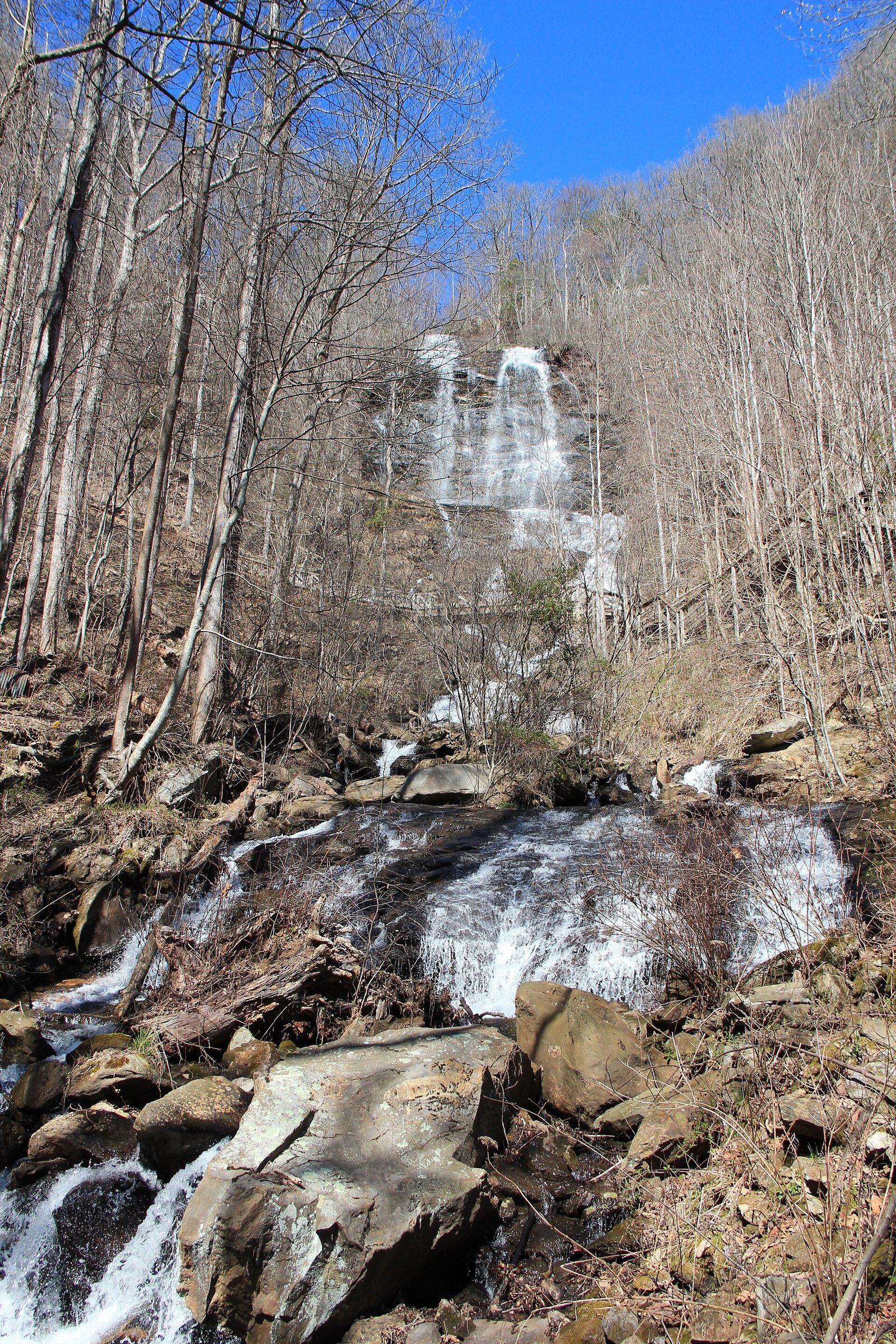
Amicalola Falls
The headline, and genuinely impressive at 729 feet of cascade down a wooded mountainside an hour and a quarter from Atlanta. The staircase is 604 steps from the reflection pool at the bottom to the top of the falls, with a viewing platform at the midpoint that is the best angle. If the stairs are not an option you can drive to the upper lot and walk down a short distance to the same platform, or stop at the lower reflection pool, which is level and close to parking.
This is also where the Appalachian Trail approach trail begins, running 8.5 miles from the stone arch to Springer Mountain. Swimming is not permitted.
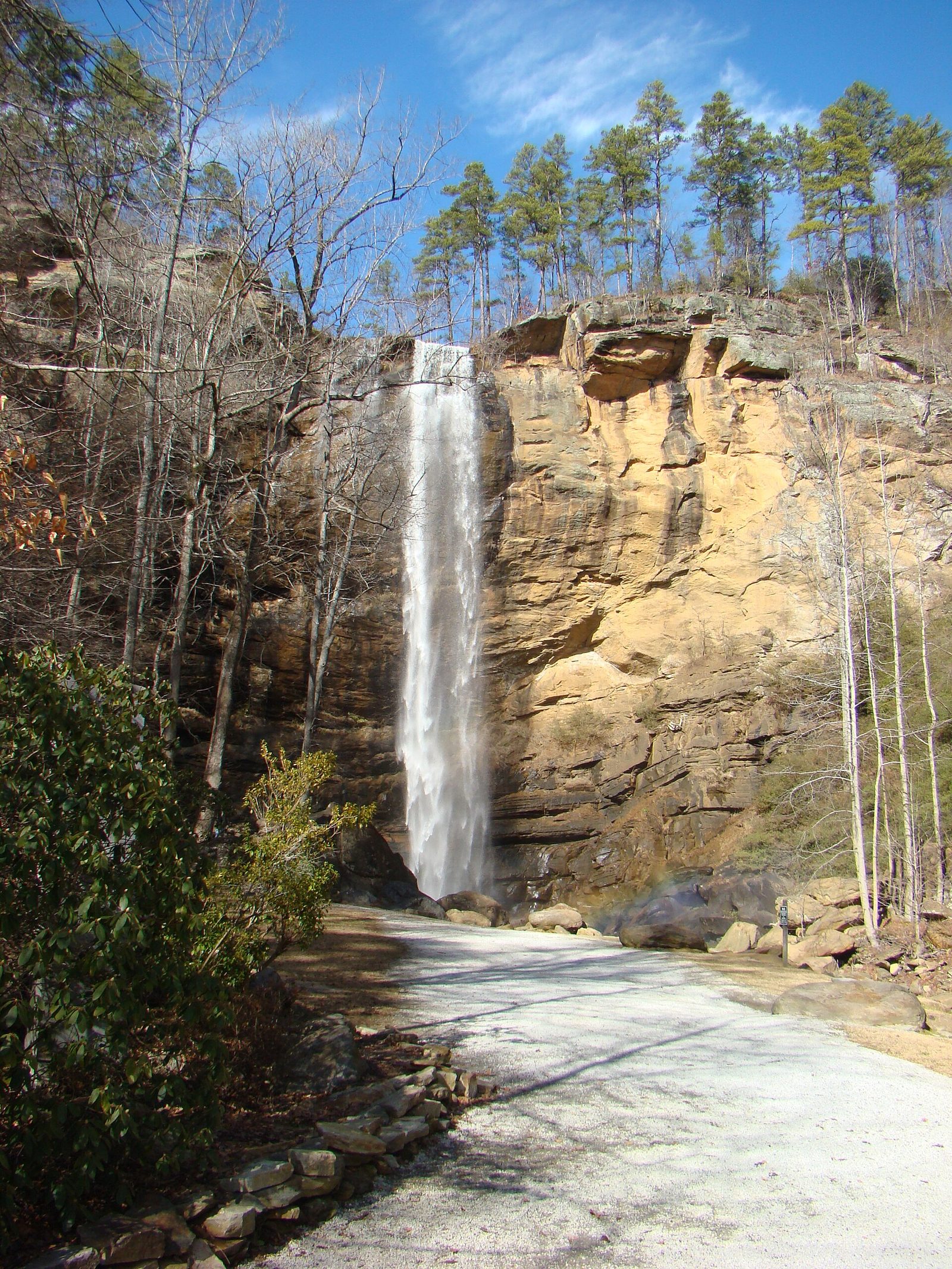
Toccoa Falls
A 186-foot single plunge — nineteen feet taller than Niagara — reached by about a hundred yards of flat gravel path from a gift shop on the campus of Toccoa Falls College. It charges a small admission, it takes twenty minutes, and it is the most spectacular waterfall-per-unit-effort in the state.
It also carries a sober history that visitors should know. On 6 November 1977 an earthen dam on the creek above the falls failed in the night and the flood killed 39 people in the college community below. There is a memorial on site. It is not a cheerful footnote, but the place deserves the context.
Anna Ruby Falls
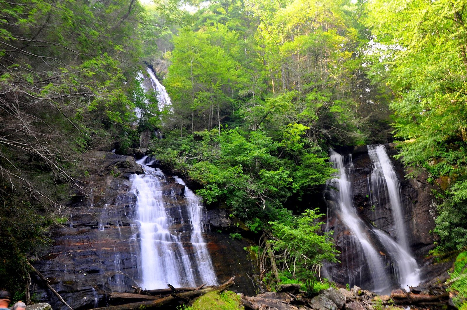
Two miles above Unicoi State Park near Helen, and the best easy waterfall walk in Georgia. Curtis Creek drops 150 feet and York Creek 50 feet into the same gorge, side by side, meeting at the bottom to form Smith Creek. The trail is paved, about four-tenths of a mile each way, with a moderate grade and benches.
It is Forest Service land, so a state ParkPass is no use: admission is $3 per person aged 16 and over, open daily 09:00 to 18:00, weather permitting (checked September 2026). It is also the busiest waterfall in north Georgia on an autumn Saturday. Go on a weekday or before ten.
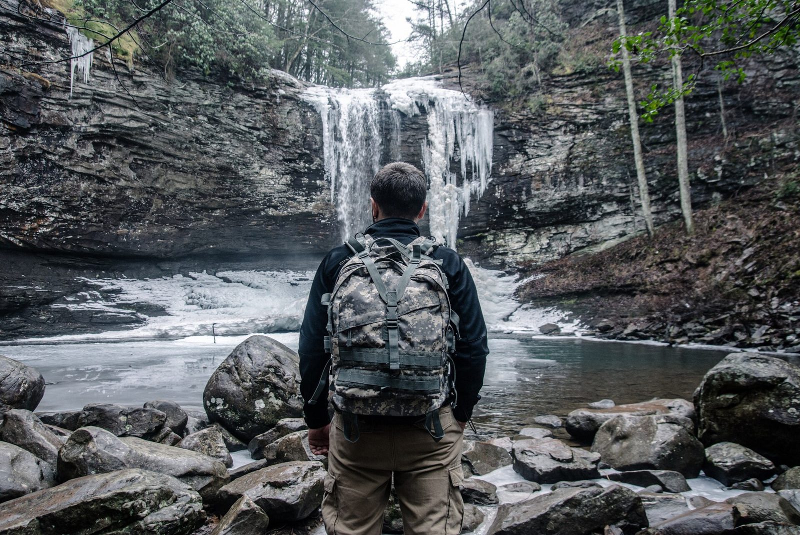
Cloudland Canyon: Cherokee and Hemlock Falls
Two waterfalls on one trail in the northwest corner of the state, reached by more than 600 metal steps down into the canyon. Cherokee Falls comes first, dropping into a deep plunge pool under an overhanging bluff; Hemlock Falls is further down and wider. Neither has a published height. The descent is easy and the return in July is a genuine effort — which is the argument for entering from the Sitton’s Gulch trailhead at the bottom instead and doing the climb first.
The Helen cluster
Dukes Creek Falls descends a series of tiers into a gorge on a well-graded trail of just over a mile each way, with a viewing deck at the bottom and shallow water above it where wading is normal. Raven Cliff Falls is the more interesting walk — five miles round trip along Dodd Creek past a string of small cascades to a fall that emerges through a cleft in a granite outcrop, which is unlike anything else in the state. Both trailheads are small and fill early.
The Blairsville cluster
Helton Creek Falls, near Vogel State Park, is two tiers reached by a walk of a few hundred yards from a small lot at the end of a rough gravel road — the drive is the hard part. Desoto Falls has an upper and a lower fall on the same trail and a Forest Service campground at the trailhead. High Shoals Falls, toward Hiawassee, gives you two falls on one trail and is reached by a gravel road with a creek ford that low cars should not attempt.
The Rabun County cluster
The northeast corner has the best density in the state and the fewest people. Minnehaha Falls near Lake Rabun is a wide tiered cascade about four-tenths of a mile from the road and one of the prettiest in Georgia. Holcomb Creek and Ammons Creek Falls sit on a single one-mile loop with a boardwalk. Becky Branch Falls above Clayton is a five-minute walk. And Panther Creek Falls, off US-441, is a seven-mile round trip to a broad fall with a sand beach at its base — the best swimming-hole-shaped destination on this list, though the trail has eroded sections above the creek that need care.
Tallulah Gorge
Six named falls inside a gorge a thousand feet deep and two miles long, which historically made this one of the great scenic attractions of the American South before the river was dammed in 1913. From the rim trails and the suspension bridge you can see L’Eau d’Or, Tempesta, Hurricane and Oceana. Reaching the gorge floor needs a free permit, 100 per day, issued from 08:00 at the interpretive center, and none are issued during scheduled water releases — which are, ironically, when the falls look most like they used to.
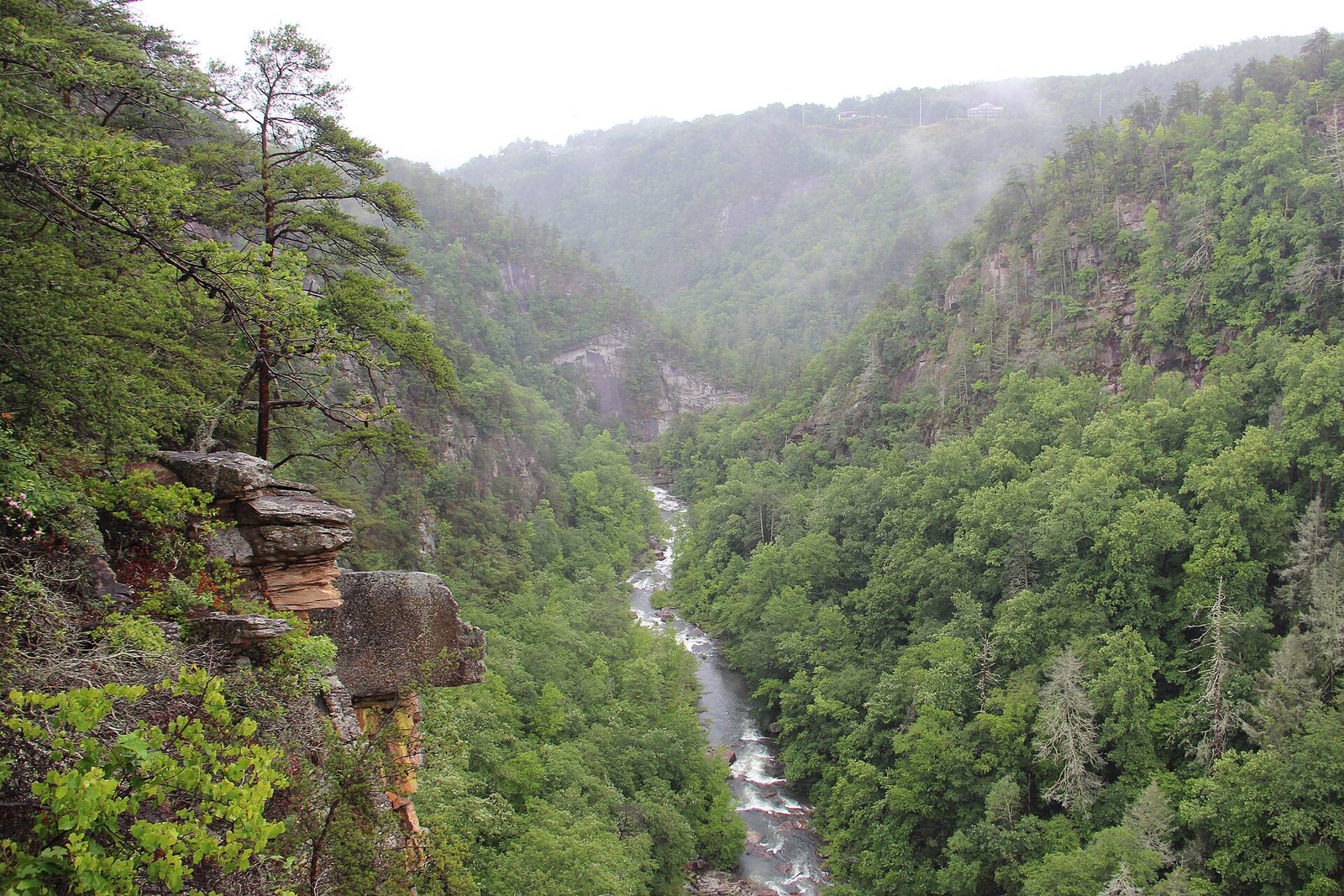
Panther Creek Falls
The most rewarding long waterfall walk in Georgia, off US-441 between Clarkesville and Tallulah. The trail runs about three and a half miles each way along a creek gorge, ending at a broad multi-tier fall with a genuine sand beach at the base — a rarity in the southern Appalachians and the reason it fills on summer weekends. Two cautions: sections of the path traverse above the creek on eroded ledges with a drop below, which is not a place for unsteady walkers or unleashed dogs, and the beach is unsupervised.
Waterfalls south of the mountains
A handful of falls sit on or just below the Fall Line, and they are genuinely different: wide shoals rather than high drops, formed where a river crosses the boundary between hard and soft rock.
High Falls State Park, an hour south of Atlanta on the Towaliga River, has the best of them — a broad staircase of shoals beside the ruins of a nineteenth-century mill town, with a boardwalk and an easy loop. Sweetwater Creek, thirty minutes west of downtown Atlanta, has a rocky shoal stretch below the New Manchester mill ruins that is not a waterfall in the mountain sense but is the closest thing to one within the city’s reach. And in the far west, Sprewell Bluff on the Flint River gives you shoals in a gorge that almost nobody visits.
These are the winter answer when north Georgia is iced, and the summer answer when the mountain trails are too hot — shaded, riverside and at lower elevation.
When the Water Actually Runs
Flow matters more than almost anything else, and most waterfall lists are silent on it.
December to April is the season. Georgia gets its heaviest rain in winter and early spring, the trees are not yet drawing it out of the ground, and the falls run at their fullest. February and March are the peak. The leaves are also off, which means you can see the full drop rather than a gap in the canopy, and a hard freeze will edge the rock with ice.
Late spring — April and May — is the best compromise: strong flow, mountain laurel and rhododendron in bloom, and comfortable temperatures.
Late summer and early autumn are the weakest. By September, after three months of evaporation and transpiration, the smaller falls can be reduced to a trickle. A long dry spell in August can turn Helton Creek or Becky Branch into wet rock. The dam-fed exceptions keep running: Tallulah’s releases and Amicalola’s larger catchment mean both are worth visiting year round.
The best single rule: go two or three days after a significant rain, not the day after. Same-day and next-day flow is dramatic but the trails are slick and the creeks can be unsafe to cross; by day three the water is still high and the rocks have drained.
Getting to the Trailheads
The access road is the underrated variable. Several of the best falls on this page sit at the end of Forest Service gravel that is fine in a saloon car in June and genuinely difficult after rain, and a few have creek fords.
Paved all the way, any car: Amicalola, Toccoa, Anna Ruby, Tallulah, Cloudland Canyon, High Falls, Dukes Creek, Raven Cliff, Panther Creek, Minnehaha.
Gravel, usually fine, slow: Helton Creek, Desoto, Holcomb and Ammons Creek, Long Creek Falls. Take it at walking pace and expect a rough last mile at Helton Creek in particular.
Check before you commit: High Shoals Falls has a creek ford on the approach road that low-clearance cars should not attempt after rain, and the Cohutta Wilderness trailheads for Jacks River are a long way down forest roads that close after storms.
Two general points. Forest Service roads are numbered rather than named and the signage is sparse, so download the map before you leave the paved highway — cell coverage across Rabun, Towns and Union counties is unreliable. And do not park in front of a gate: those are access routes and the Forest Service tows.
What the Dams Changed
Georgia’s waterfalls look the way they do partly because of what happened to them in the early twentieth century, and it is worth a paragraph.
Tallulah Gorge was one of the great scenic attractions of the American South in the 1800s — a resort town grew up on the rim, trains brought visitors from Atlanta, and the six falls in the gorge ran at full river volume. In 1913 Georgia Power dammed the Tallulah River above the gorge for hydroelectricity, and the falls have run at reduced flow ever since. The scheduled water releases, a handful of weekends a year, are the only time you see something close to the original, and the gorge floor is closed on those days for obvious reasons. Check the release schedule if the full spectacle is what you want; go on any other day if walking the floor is.
The same logic applies more broadly. Georgia’s mountain rivers were extensively dammed between 1910 and 1960 for power and flood control, which is why the state has a great many modest waterfalls and relatively few large ones outside the protected drainages. The falls that remain at full natural flow — Anna Ruby, Dukes Creek, Raven Cliff, the Cohuttas — are the ones on creeks too small to be worth damming, which is a slightly melancholy reason for their survival.
Safety, Properly Stated
The Chattahoochee-Oconee National Forest runs a standing alert about waterfall dangers, and the reason is blunt: serious injuries and fatalities happen at Georgia waterfalls every year. The Forest Service guidance is to heed posted warning signs and stay on established trails. Almost every incident follows the same pattern.
Wet rock above a fall. The rock at the lip is polished by water and covered in algae, and it is slicker than ice — genuinely, not figuratively. People step out for a photograph, lose their footing and cannot stop. If there is a railing or a marked viewing platform, the view from it is the view you are meant to have.
Jumping into pools. Depth changes with flow, and a pool that was twelve feet deep in April can hold four feet and a submerged log in September. Nobody should enter a plunge pool feet-first from height without knowing what is under it that week.
Flash flooding. Narrow gorges rise fast after rain that fell miles upstream, sometimes under blue sky where you are standing. If the water starts to color up or rise, leave the creek.
Climbing beside a fall. The ground either side is usually loose, steep and wet, and a slip there puts you in the water above the drop.
Take children’s hands at overlooks, keep dogs leashed near the edge, and accept that the good photograph is the one taken from the platform.
Where You Can Actually Swim
The rules differ by managing agency and this is where people get it wrong.
Georgia State Parks do not permit swimming at their waterfalls — that includes Amicalola and the falls at Vogel. Tallulah Gorge has a designated area on the gorge floor reachable with the free permit, and nowhere else in the gorge. On national forest land the position is looser: several falls, including Dukes Creek, have shallow pools where wading is normal and accepted, and Panther Creek’s beach is a long-standing swimming spot.
The practical instruction is simply to read the sign at the trailhead, because it reflects that specific site’s rules and the current conditions. Where swimming is allowed it is still unsupervised: there are no lifeguards at any waterfall in Georgia, the water is cold enough year round to cause a gasp reflex, and the rocks underfoot are uneven.
Accessible Waterfall Viewing
Better than you might expect, and concentrated in four places.
Anna Ruby Falls is the strongest: a paved trail with a moderate grade to a viewing platform looking straight at both falls, with accessible parking and restrooms at the visitor center. Amicalola Falls has a reflection pool and lower viewing area reachable by car with a short level path, and an upper lot that puts you near the top platform — you can see the falls from both ends without the 604 steps. Tallulah Gorge‘s rim overlooks are paved and give the full gorge view. High Falls State Park, south of Atlanta on the Towaliga River, has a boardwalk along the shoals.
The national forest falls reached by dirt trail — Dukes Creek, Raven Cliff, Minnehaha, Helton Creek — are not accessible, and several have rough gravel access roads before you even reach the trail.
Four Waterfall Days That Work
The Helen loop
Anna Ruby Falls first thing, before the visitor center fills, then Dukes Creek at mid-morning and Raven Cliff after lunch. Three falls, about six miles of walking, and the Russell Scenic Highway on the way home. The best single waterfall day in Georgia.
The Blairsville loop
Helton Creek Falls early — the gravel road is easier without oncoming traffic — then Desoto Falls, with the option of High Shoals toward Hiawassee if the ford looks passable. Vogel State Park for lunch. Quieter than the Helen loop and about the same walking.
The Rabun County loop
Minnehaha in the morning, Holcomb and Ammons Creek on their loop, and Becky Branch above Clayton in the late afternoon, with dinner in Clayton. Four falls, under three miles of total walking, and very few people. Add Panther Creek as a separate day rather than squeezing it in.
The big two
Amicalola in the morning and Toccoa Falls in the afternoon is about an hour and a half of driving between them and pairs the tallest waterfall in Georgia with the tallest single drop. It is a satisfying contrast and almost nobody does it.
With Children, With Dogs, and Avoiding the Crowds
With children, the reliable four are Anna Ruby Falls (paved, short, and the visitor center has restrooms), Toccoa Falls (a hundred yards of flat gravel), Helton Creek Falls (a few hundred yards, with shallow water) and High Falls State Park (boardwalk and picnic ground). Avoid Panther Creek, whose eroded ledge sections are genuinely exposed, and think carefully about Amicalola’s 604 steps with anyone small — the drive-to-the-top option exists for a reason.
With dogs, leashed pets are welcome at Georgia’s state park falls on a six-foot leash and on national forest trails throughout. Four practical notes: metal stair treads at Amicalola and Cloudland Canyon are hard on paws and some dogs will simply refuse them; wet rock near a fall is as slick for a dog as for you and a leash is what stops a slip becoming a fall; creek crossings at High Shoals and in the Cohuttas run faster than they look; and dogs are not permitted in the water where swimming itself is prohibited.
To avoid the crowds, the arithmetic is simple. Two falls absorb most of the visitors — Anna Ruby and Amicalola — because both are short, signposted and attached to well-known parks. Both are pleasant at 09:00 on a Tuesday and unpleasant at 13:00 on an October Saturday. Everything in Rabun County, everything reached by gravel, and everything requiring more than two miles of walking is quiet almost all the time. If you want a waterfall to yourself on a peak weekend, drive to Minnehaha, Holcomb Creek or High Shoals and you will likely have it.
Photographing Them
Waterfall photography in Georgia is easier than most places for one reason: the canopy. Direct sun on a fall produces blown-out white water and black shadow, and the hardwood cover here means most of these falls are in soft light for much of the day.
The conditions to want are an overcast day after rain, which gives even light and full flow, and either early morning or late afternoon if the sky is clear. The silky-water effect needs an exposure of roughly half a second or longer, which means a tripod or a rock, and in bright conditions a neutral density filter. A polarizer cuts the glare off wet rock and deepens the green of the surrounding leaves, and is the single most useful piece of glass to own for this.
The seasonal choice matters more than the gear. Winter gives you the whole drop with no leaves in the way and the strongest flow, plus the chance of ice at the edges. Spring gives you flow plus mountain laurel and rhododendron. Autumn gives you color but usually the weakest water of the year, which is why so many autumn waterfall photographs from Georgia look thinner than the ones in the brochures — those were taken in March.
One request rather than a tip: the photograph is not worth leaving the platform for. Every year in this state somebody climbs the wet rock beside a fall for a better angle and does not come back, and the resulting picture would have been marginally better than the one from the railing.
Before You Go: Checking Conditions
Waterfall access changes more often than trail lists do. Forest roads wash out, trails close after storms, Tallulah suspends gorge permits for water releases, and Anna Ruby closes in bad weather.
Check the managing agency directly the morning you leave: gastateparks.org for the individual park’s alerts page at Amicalola, Tallulah, Cloudland Canyon and High Falls; the Chattahoochee-Oconee National Forest pages on fs.usda.gov for forest road and trail closures and the standing waterfall-dangers alert; and the park itself by phone if the drive is over two hours. Rangers answer and will tell you honestly whether the water is worth the trip that week — which is a question no website can answer for you.
Frequently Asked Questions
What is the tallest waterfall in Georgia?
Amicalola Falls, at 729 feet. It is a cascade rather than a single drop, which is why it is usually described as the tallest cascading waterfall east of the Mississippi. The tallest single plunge is Toccoa Falls at 186 feet, which is taller than Niagara.
When is the best time to see Georgia’s waterfalls?
December through April, and February and March above all — heaviest rainfall, fullest flow, and leafless trees so you can see the whole drop. Late spring is the best compromise with the weather. Late summer and early autumn are the weakest, when small falls can dry to a trickle.
Can you swim at Georgia waterfalls?
Not at state park waterfalls, including Amicalola. Tallulah Gorge has one designated area reachable with the free gorge-floor permit. Some national forest falls, such as Dukes Creek and Panther Creek, have pools where wading and swimming are normal. Read the sign at the trailhead — the rules are set site by site.
Which waterfall has the easiest walk?
Toccoa Falls, at about a hundred yards of flat gravel from the gift shop. Anna Ruby Falls is the best paved option at four-tenths of a mile each way. Amicalola’s lower reflection pool and upper platform are both reachable by car if the 604 steps are not possible.
Do I have to pay to see Georgia’s waterfalls?
Sometimes. State park falls need a $10 daily ParkPass per vehicle. Anna Ruby Falls charges $3 per person aged 16 and over because it is Forest Service land, which the ParkPass does not cover. Toccoa Falls charges a small admission. Most other national forest trailheads are free.
How many waterfalls does Georgia have?
Roughly two hundred named falls, essentially all of them north of the Fall Line that runs through Columbus, Macon and Augusta. About twenty are worth a dedicated trip and they cluster around Helen, Blairsville, Clayton and the northwest corner.
Why do the listed heights vary so much?
Because sources measure different things without saying so — a single plunge, the total cascade from the first ledge to the last, or the tallest tier of a multi-tier fall. This guide publishes a height only where a managing agency or reference source gives one.
Are Georgia waterfalls dangerous?
The falls are not; the wet rock around them is. The Forest Service maintains a standing alert because serious injuries and deaths occur every year, almost always after someone leaves the trail or a railing to get closer. Algae-covered rock at the lip of a fall is slicker than ice. Stay on the marked trail and use the viewing platform.
Most of these falls sit on water that is managed further downstream, and the same agencies that set the rules at a waterfall set them at the reservoir below it. Our guide to lakes in Georgia covers the wider picture — the reservoirs, the rivers, the fishing licenses and, importantly, why the water below a dam behaves nothing like the water above it.
Anna Ruby Falls is the easiest genuinely impressive waterfall in the state — half a mile on pavement, $3 a head, two creeks arriving on the same rocks — and almost everyone who visits it is basing themselves in Helen two miles down the road. Our Helen first-time visitor guide covers the town, Unicoi State Park and the Forest Service fees that the ParkPass does not cover.
Related Georgia Guides
- Best hikes in Georgia — thirty-eight trails with normalized distances, permits and hunting-season dates.
- Best Georgia state parks — all 49 by drive time, with the ParkPass rules and Tallulah’s permit system.
- North Georgia mountains guide — base towns, roads and where to stay near the falls.
- Cabins in Georgia — what a cabin near these trailheads really costs.
Photo Credits
Amicalola Falls (featured image): photo by Thomsonmg2000 / Wikimedia Commons (CC0)
Toccoa Falls: photo by FloNight (Sydney Poore) and Russell Poore / Wikimedia Commons (CC BY-SA 4.0)
Anna Ruby Falls: photo by Chanilim714 / Wikimedia Commons (CC BY-SA 3.0)
Waterfall at Cloudland Canyon State Park: photo by Nikolay Loubet / Wikimedia Commons (CC BY 3.0)
Tallulah Gorge from an overlook: photo by Thomson200 / Wikimedia Commons (CC0)
Sources and Corrections
Heights for Amicalola Falls, Toccoa Falls and Anna Ruby Falls are per the New Georgia Encyclopedia and Explore Georgia, September 2026; no height is published here for any fall where those sources disagree or are silent. Anna Ruby Falls fees and hours are per the US Forest Service. ParkPass rates and the Tallulah Gorge permit rules are per Georgia State Parks. The waterfall safety guidance reflects the Chattahoochee-Oconee National Forest’s standing waterfall-dangers alert; the alert page itself returned an access error when we tried to read it directly, so no casualty figures are quoted. Swimming rules vary by site and by season, and the posted sign at the trailhead is the authority. Conditions and flow change fast; check the managing agency before you drive.
Georgia Tourism Guide is an independent publication. We are not affiliated with Explore Georgia, the Georgia Department of Natural Resources, the National Park Service or any attraction listed here.